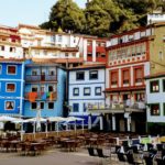
As we already showed you in our article about the perfect road trip around Tenerife, the Canary Island is a true eventing bomb: There is almost nothing you can’t do on the largest of the Canary Islands. Therefore, in the last post, hiking tours were a bit missing out. We would like to make up for that, as Tenerife turned out to be the absolute hiking paradise for us. Having said that, we’ll reveal our personal 5 highlights of the most beautiful hiking trails to you in this article.![]()
Everything at a Glance
For a better overview, we’ll show you our Tenerife map again, where you can see in yellow our favorite hiking areas. All other points on the map can be hidden and unhidden at will.

And here they are, our 5 most beautiful hikes in Tenerife (in ascending order):
- Paisaje Lunar
- Faro de Anaga
- Las Cañadas del Teide
- Pico del Teide
- Chinamada – Punta del Hidalgo
Masca Gorgecurrently closed
When hiking, please always pay attention to the weather and possible storm forecasts as well as to good equipment, sufficient water supplies and emergency provisions of food. What we take with us on every hike, you will learn at the end of the article.
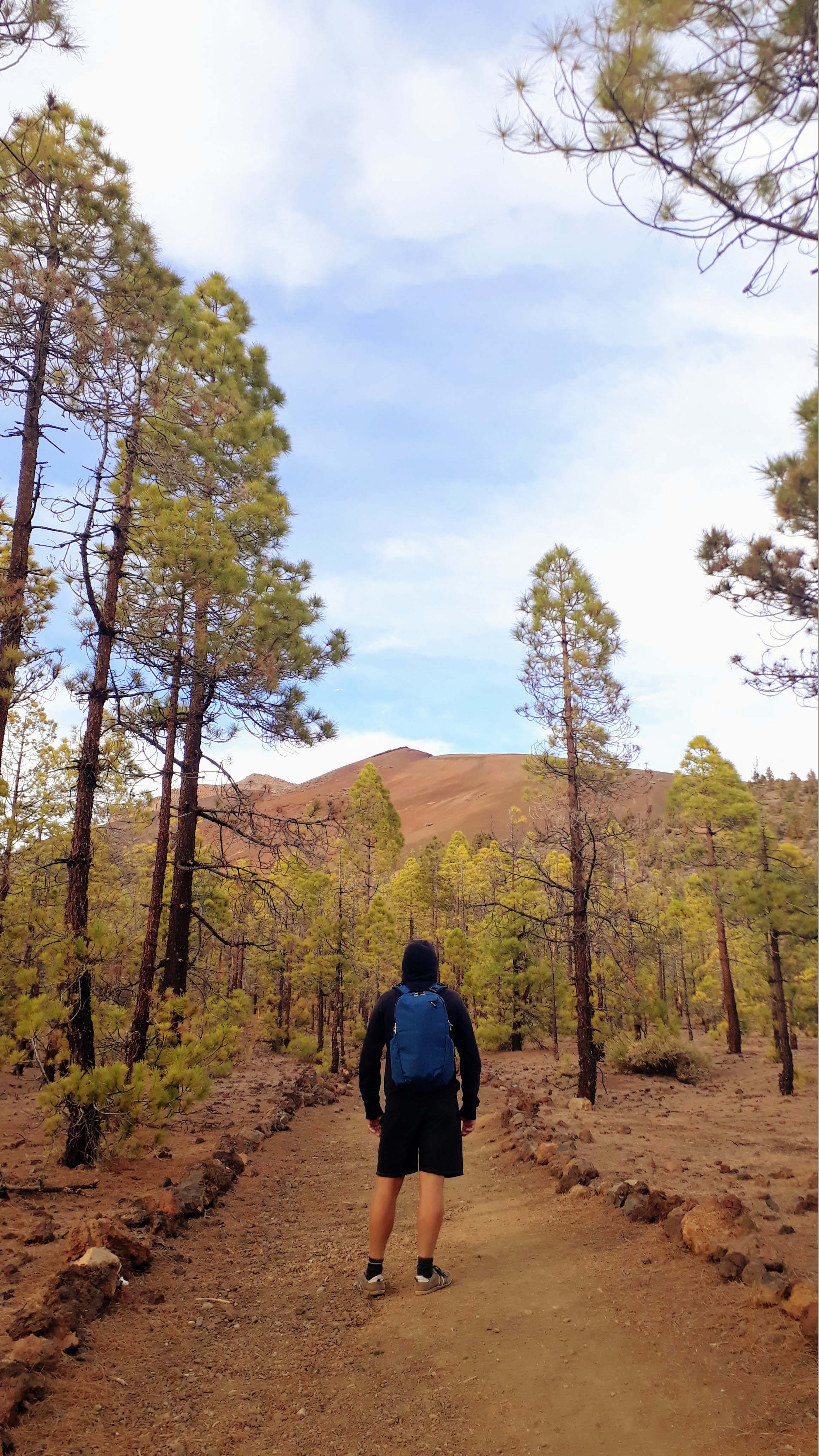
1. Paisaje Lunar: A Trip into a Lunar Landscape

In order to get to the lunar landscape, as Paisaje Lunar means, you go by car to a gravel parking lot about 2 kilometers (as the crow flies) northeast of Vilaflor. From there, a circular trail of about 7 kilometers leads through a forest to the unique rock formation at the edge of the Teide Caldera.

But don’t let yourself be fooled by the images on the internet, as it is not allowed to go that close to – let alone into – the moonscape. “Legally”, it can only be viewed from a relatively distant view point. In our opinion, the walk is still worthwhile because of the beautiful forest path. Schedule about 1.5 to 2 hours for the trail.
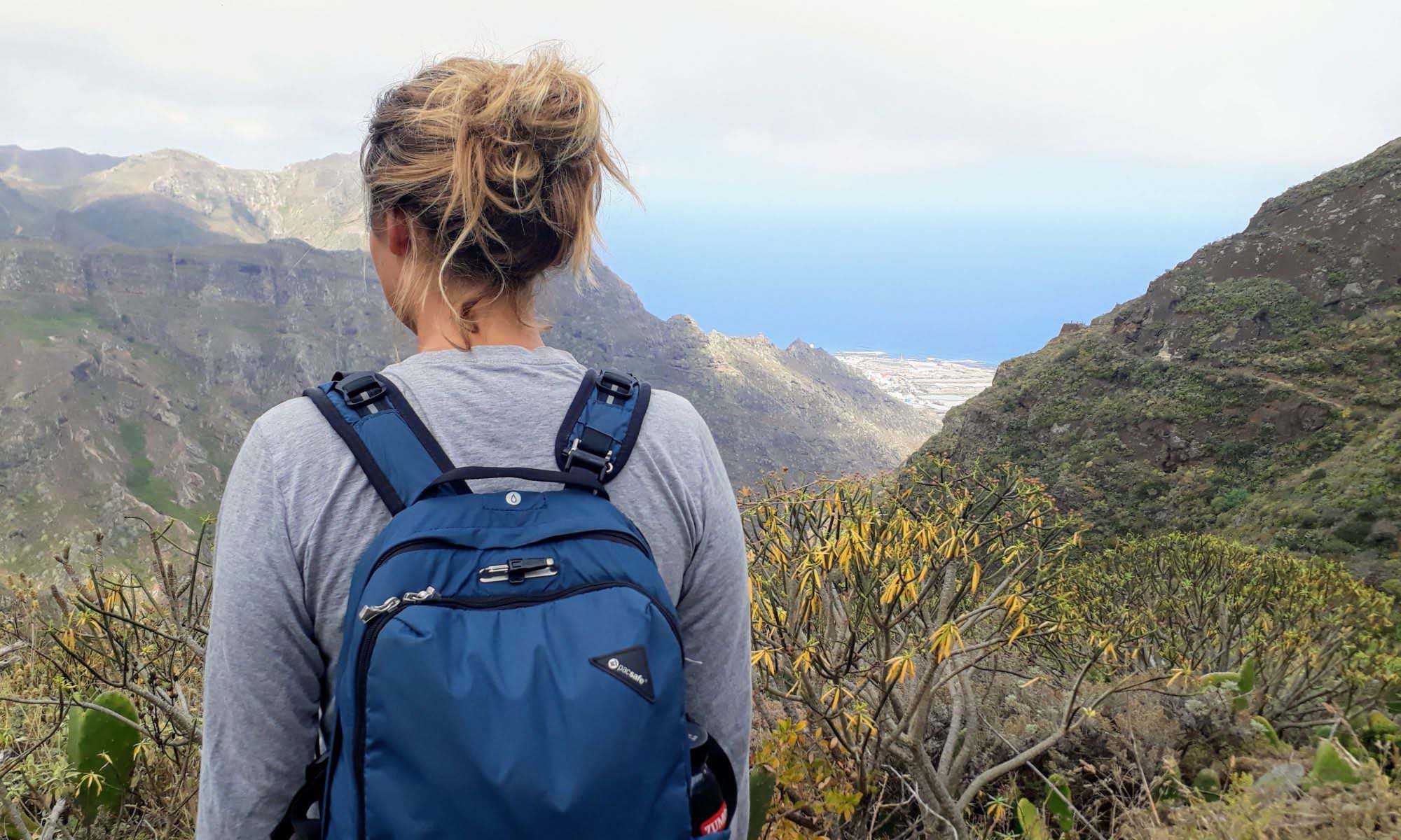
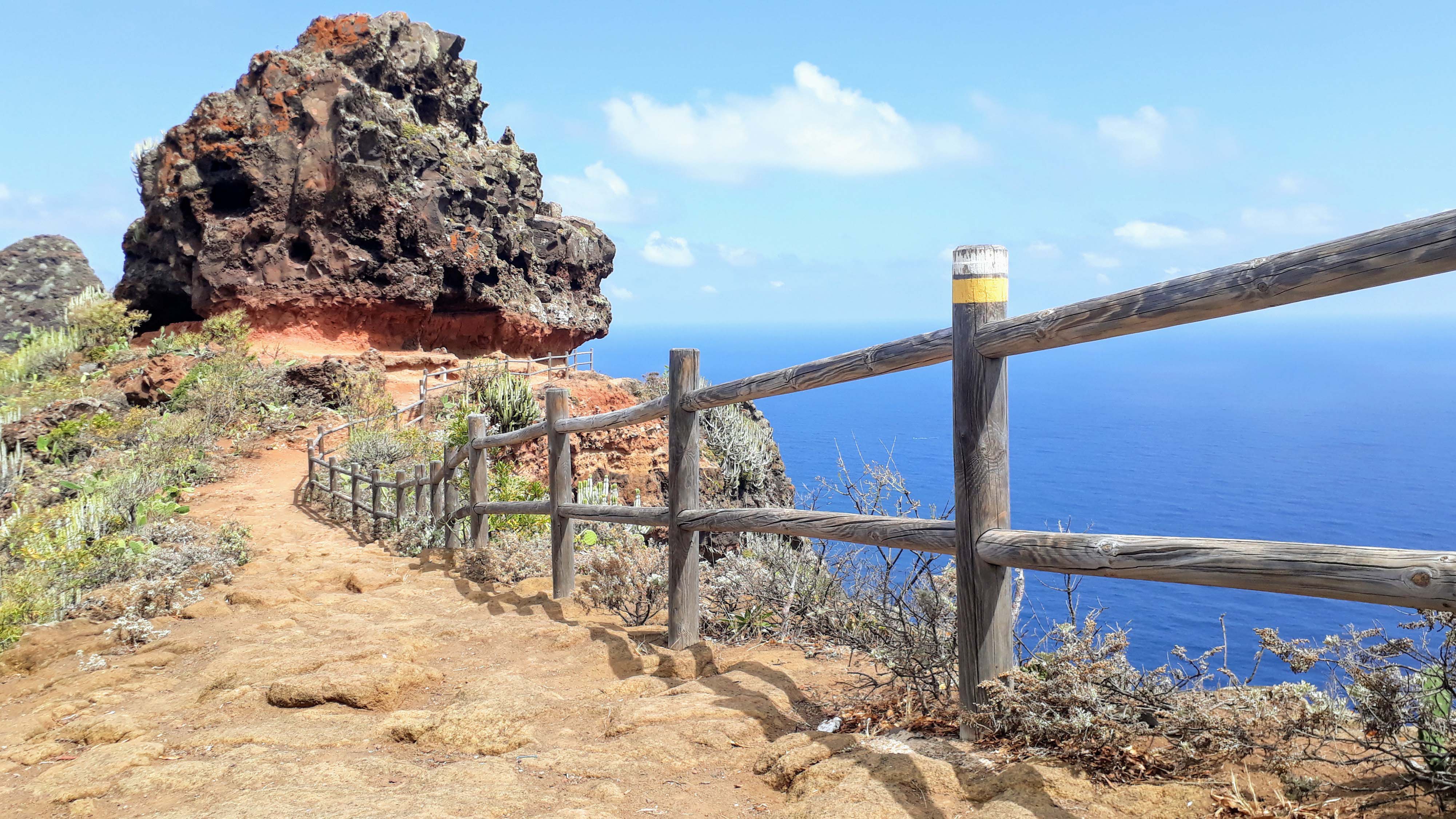
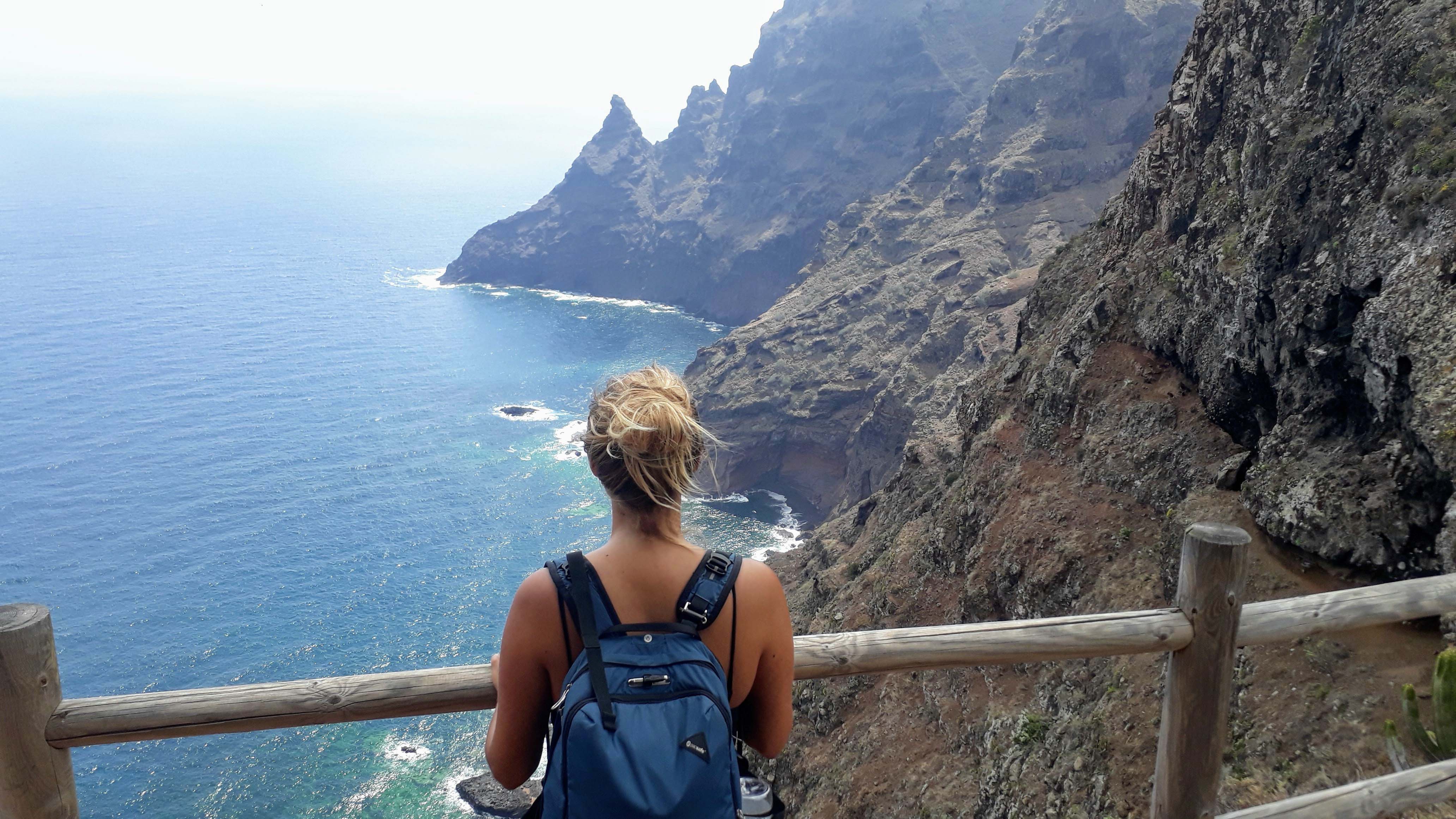
2. Faro de Anaga: Hiking in the UNESCO Biosphere Reserve
Seven to nine million years ago, volcanic activity formed the Anaga Mountains. They cover the entire northern tip of Tenerife and were declared a UNESCO Biosphere Reserve in 2015. Finally, there are large areas of laurel forest, for which the frequent fog and rain on the crest of the mountains called Macizo de Anaga in Spanish provide ideal growing conditions. Typical of the region are the caves in the volcanic rock whose facades and interiors resemble those of ordinary family houses, such as in Afur and Chinamada.
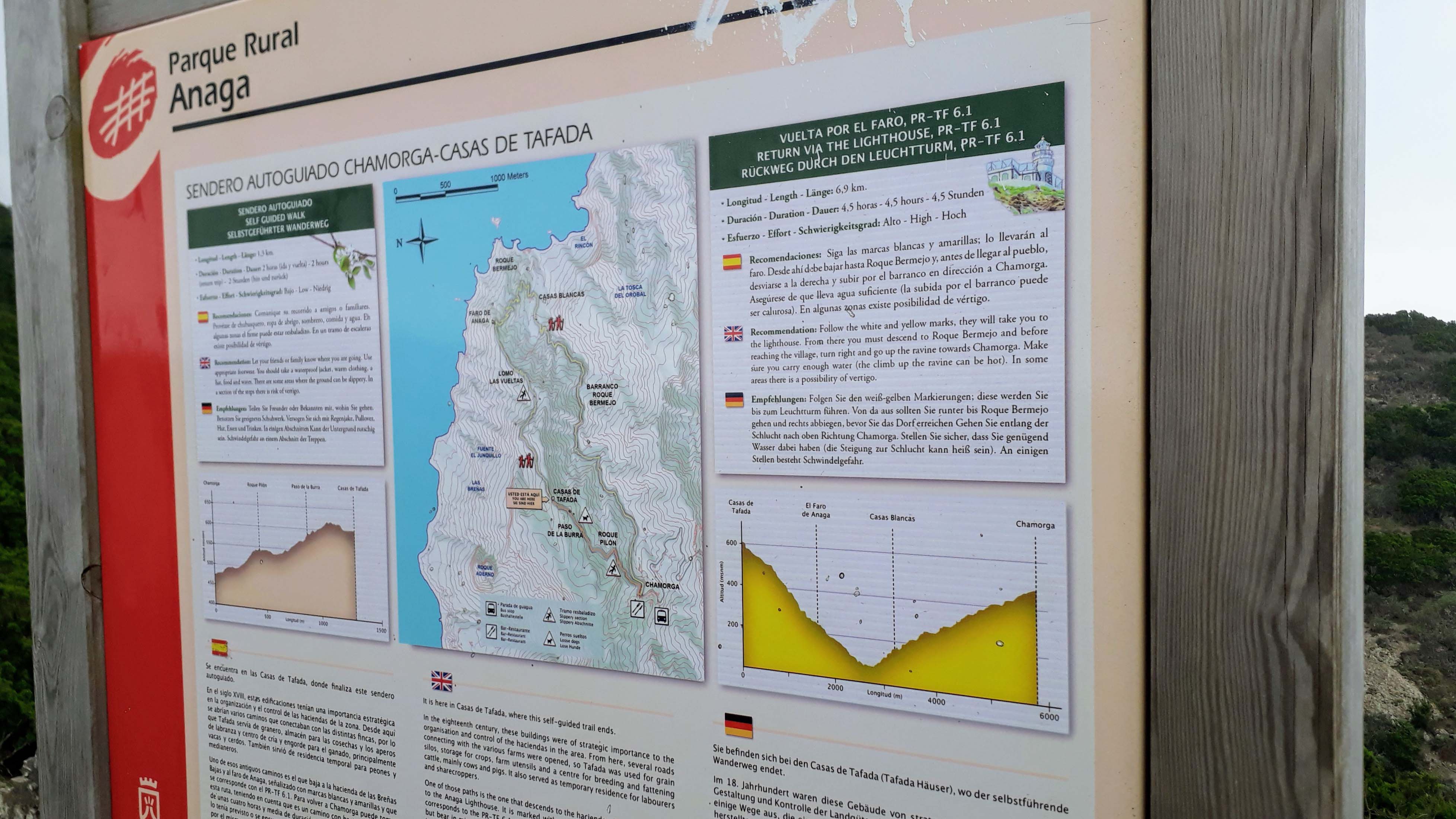
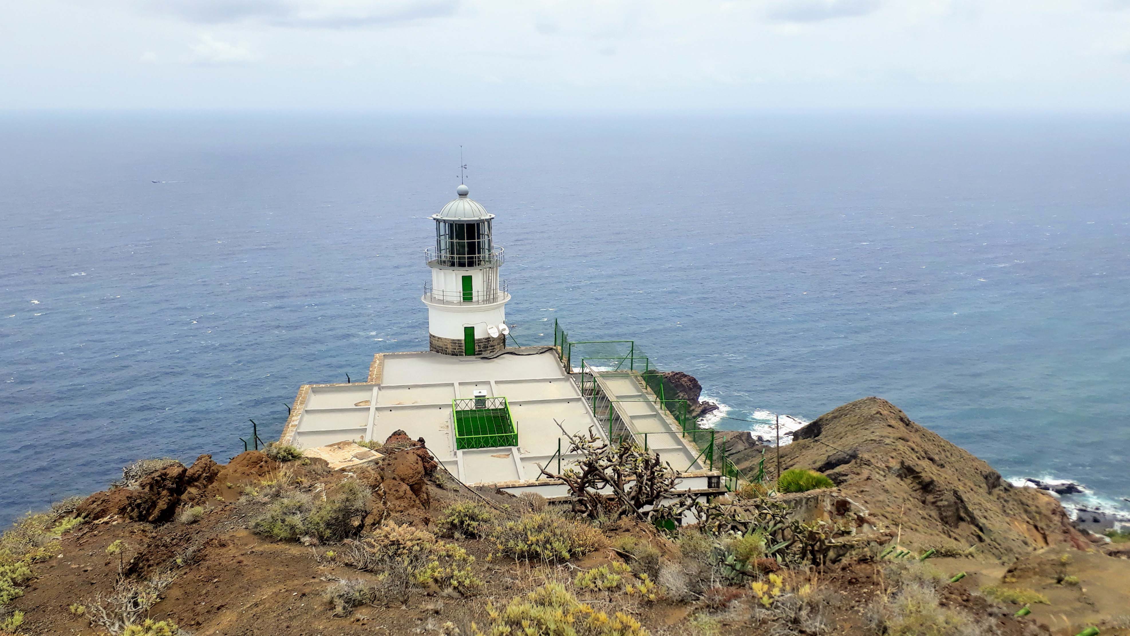
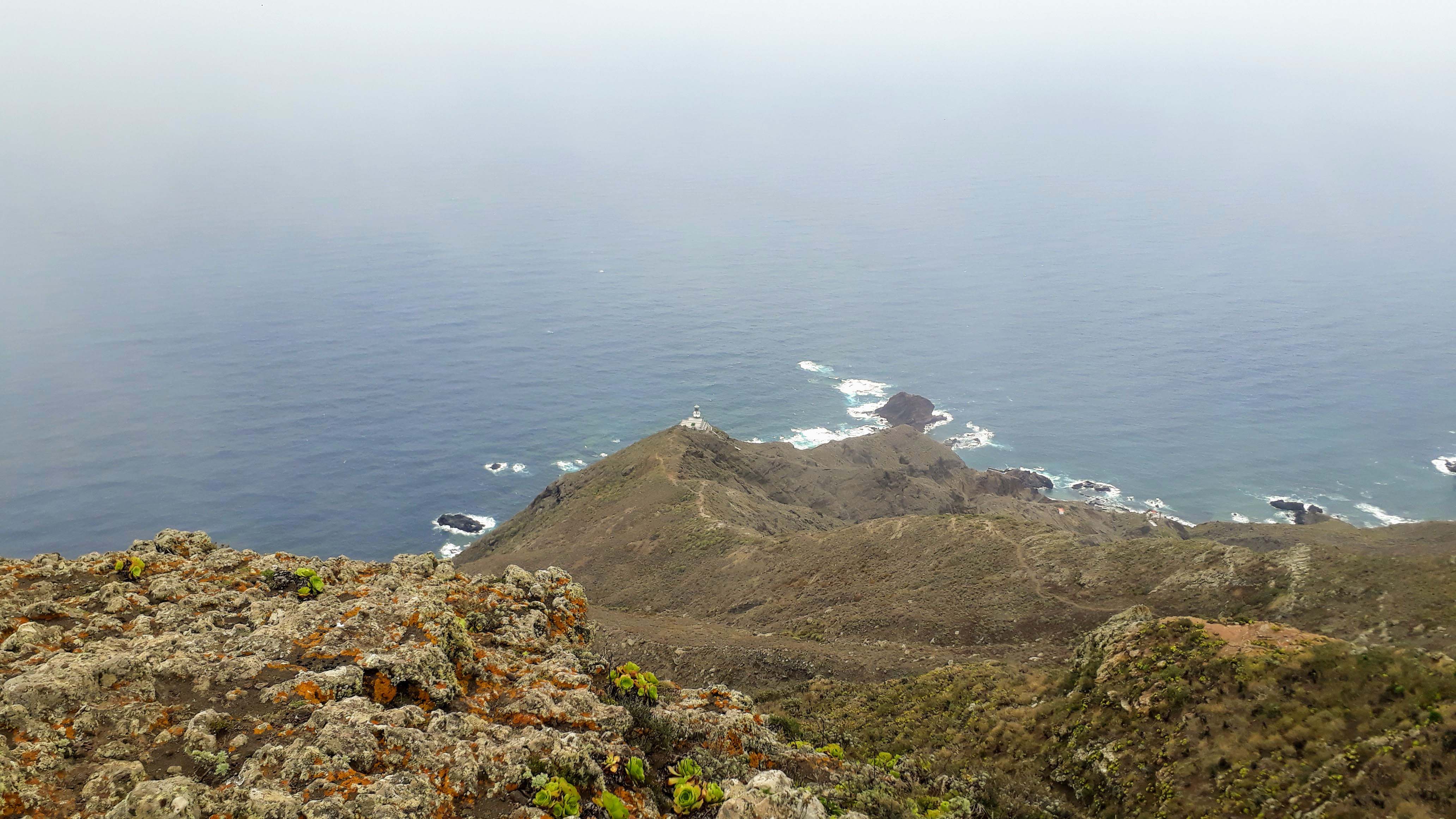
In the Anaga Mountais starts our next hike. From the village of Chamorga and via the viewpoint Roque del Pilón and Paso La Burra you get to the Casas de Tafaga. Here, you can either turn around, if you just want to take a short walk. Or you keep walking along Lomo Los Codesos to the lighthouse Faro de Anaga. From there, you’ll get back via the village Roque Bermejo and through the gorge Barranco de Roque Bermejo to Chamorga.

In total, these are about 7 to 8 kilometers (the signs contradict each other) and the hike is marked as “difficult” with a total duration of 5 hours and 30 minutes. We needed about 4 hours including some smaller breaks. The track is sometimes quite steep, both downhill and uphill, but quite easy to overcome with average condition.
If you don’t feel like hiking that far, be reassured that the view is already very good, if you climb past the Casas de Tafaga a bit further. Depending on how far you keep going, an increasingly better view over the entire northeast coast of Tenerife will be offered to you.
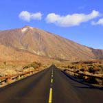
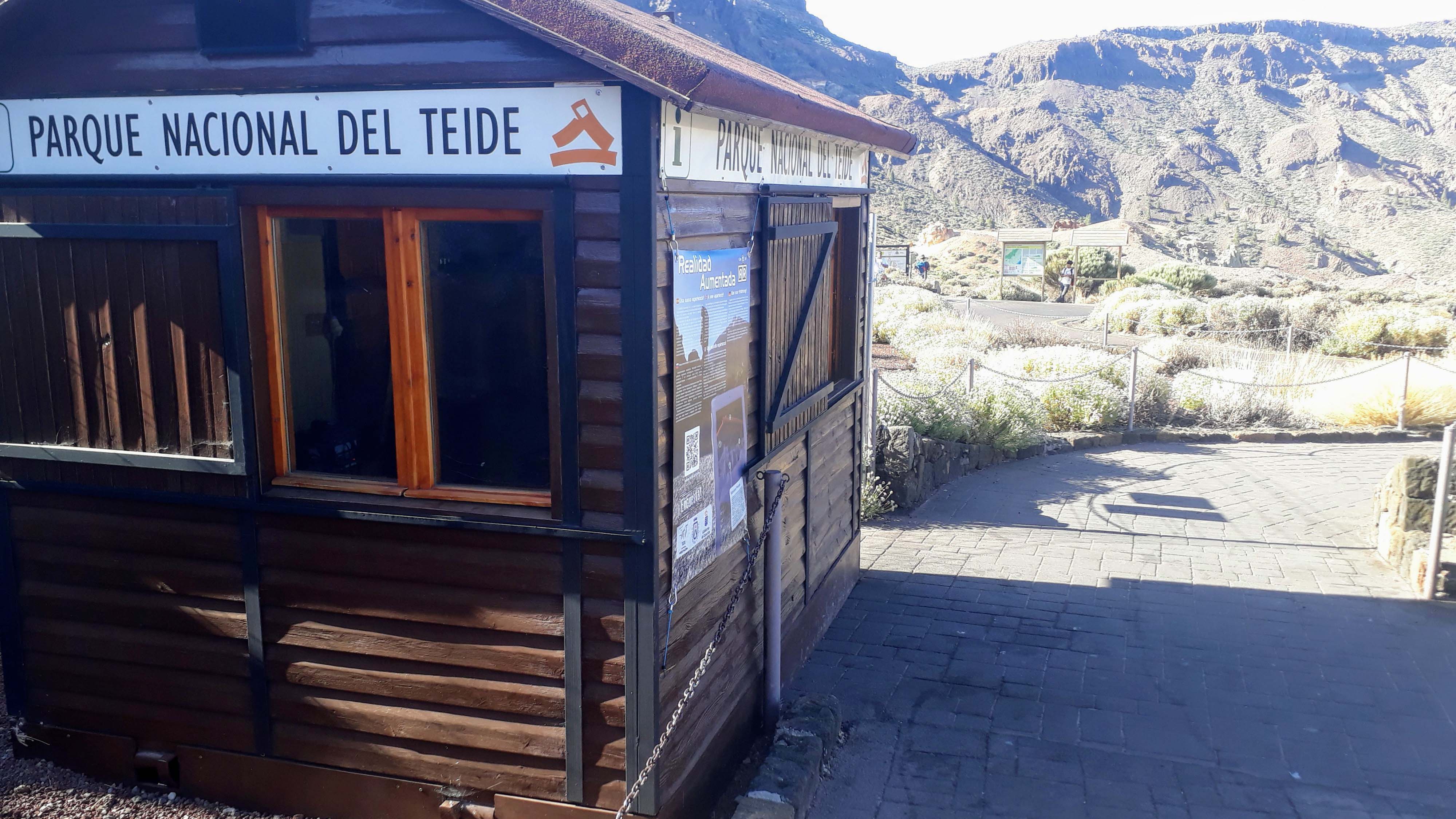
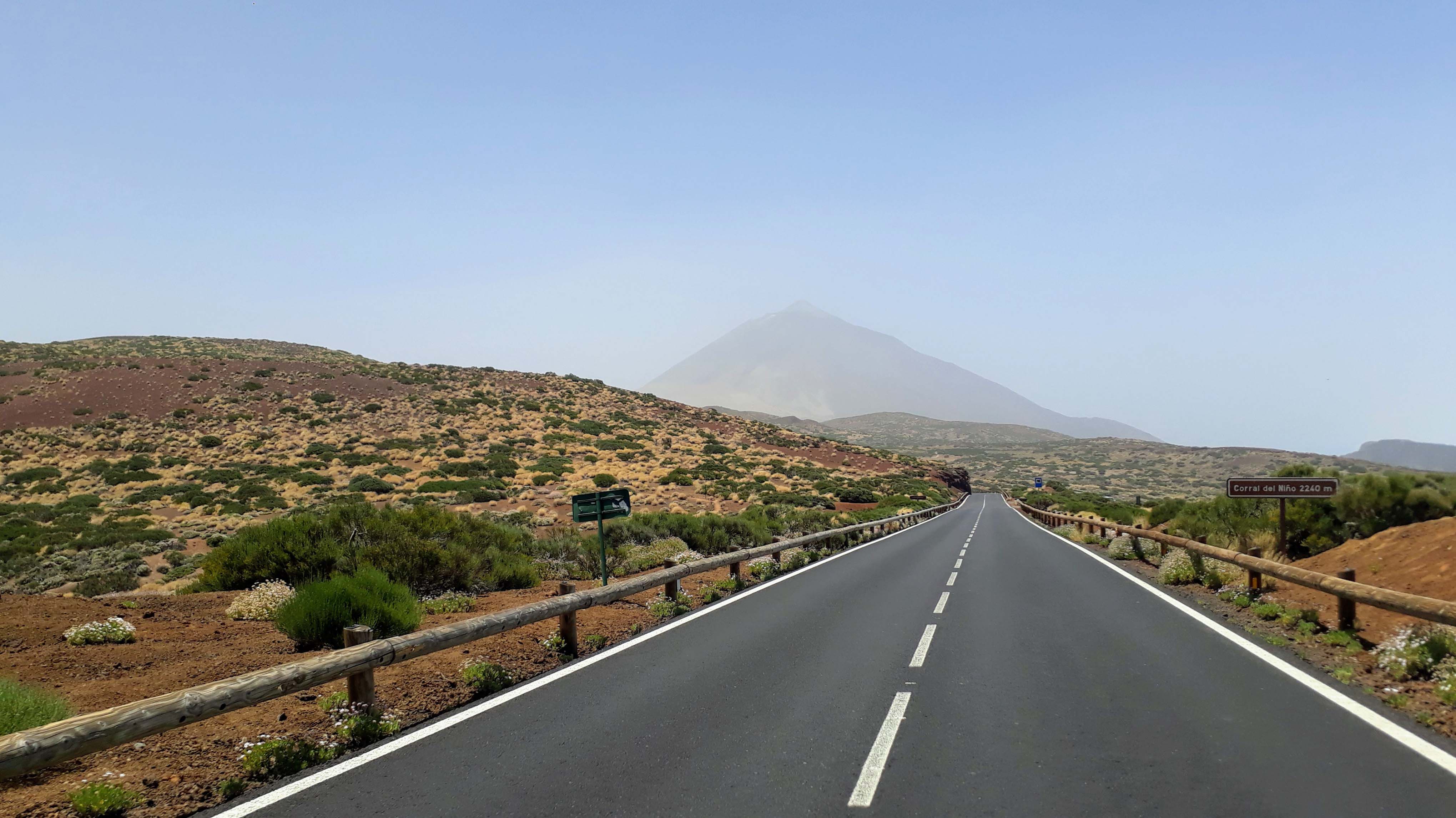
3. Las Cañadas del Teide: Panorama over the Volcanic Crater
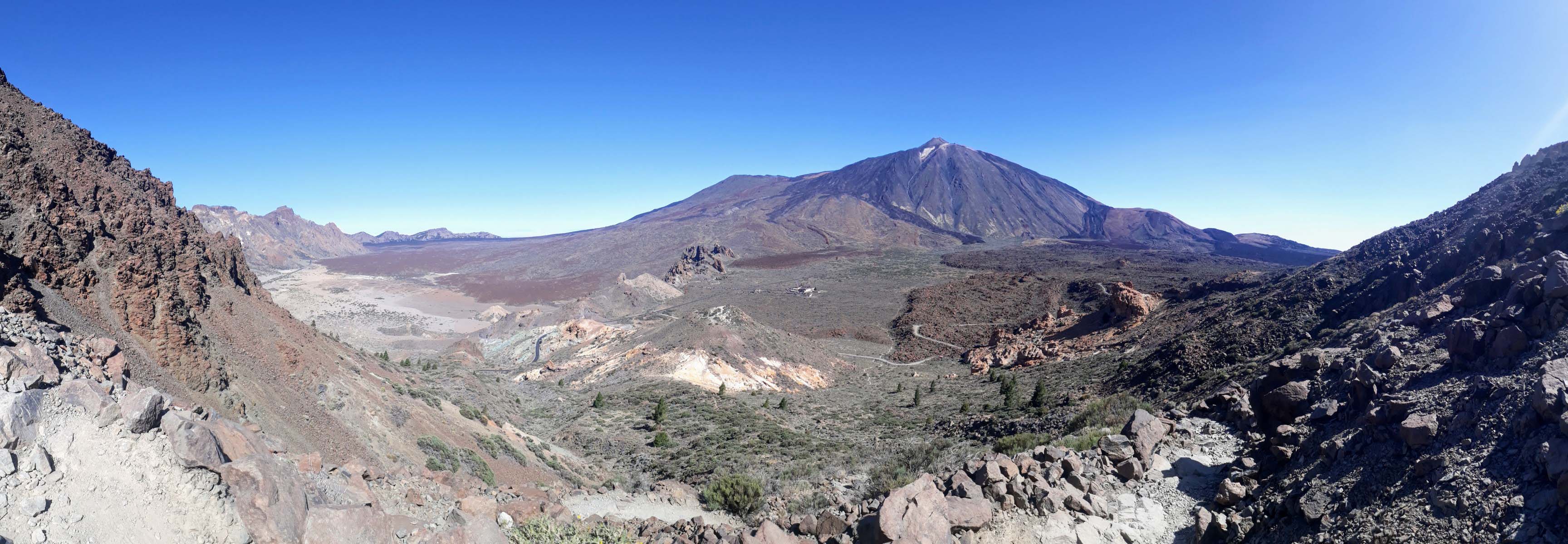
It’s getting exciting: For our next hike we are already in the Parque Nacional del Teide. As the largest and oldest reserve of this kind in the Canary Islands, the national park was established in 1954 and declared a UNESCO World Heritage Site in 2007. It is named after the volcano Teide, which at 3718 meters is the highest mountain on Spanish territory. The Teide National Park is a popular hiking area: A network of more than 40 official hiking routes leads to its various attractions.
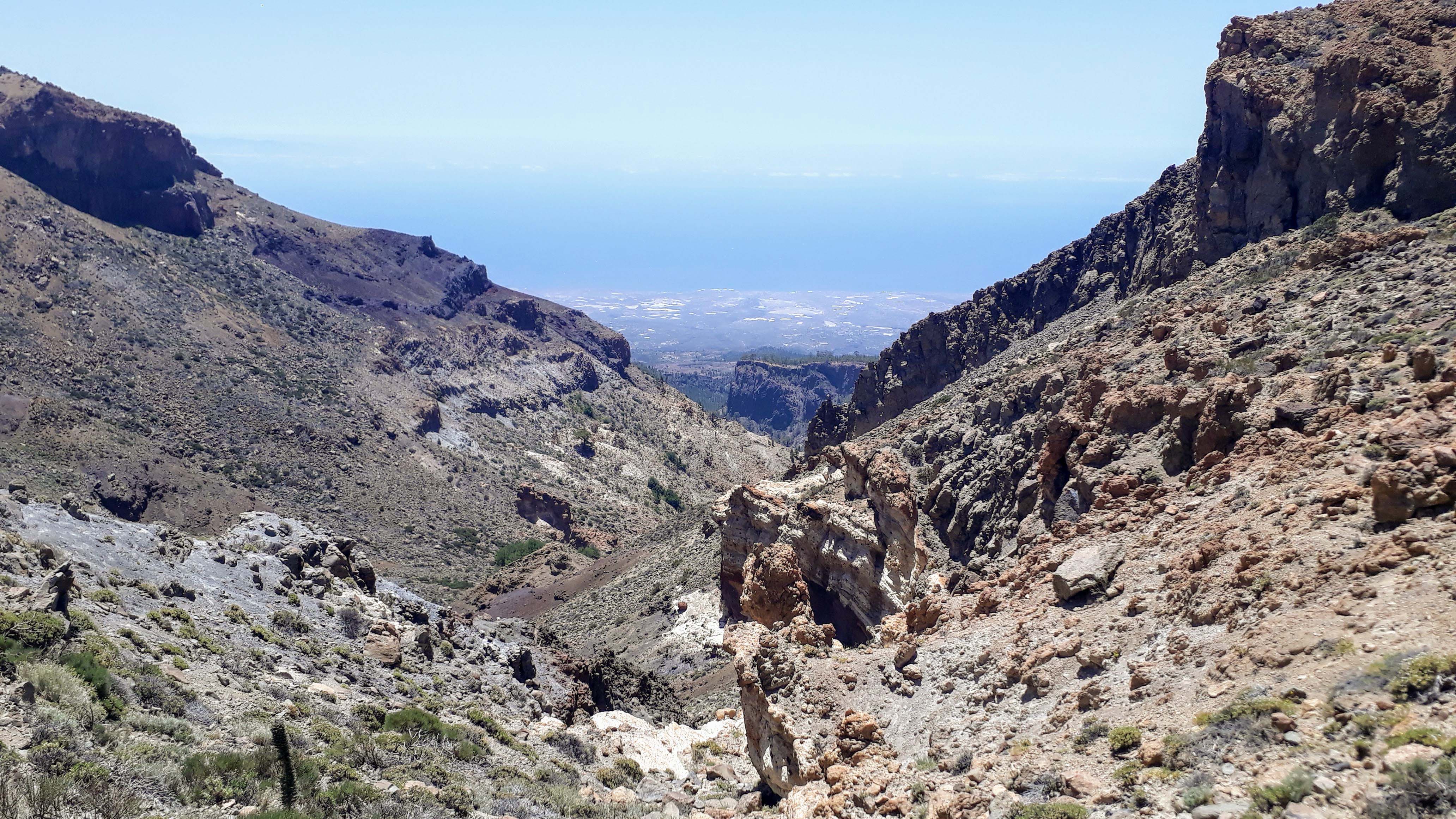
However, before we climb the summit of the stratovolcano, we first want to explore the volcanic Caldera de las Cañadas del Teide. The huge volcanic caldera in the center of the island is located at an almost continuous height of over 2000 meters and is limited to the south by on average 500 meter high crater walls. With a diameter of about 17 kilometers, it is one of the largest volcanic calderas in the world.
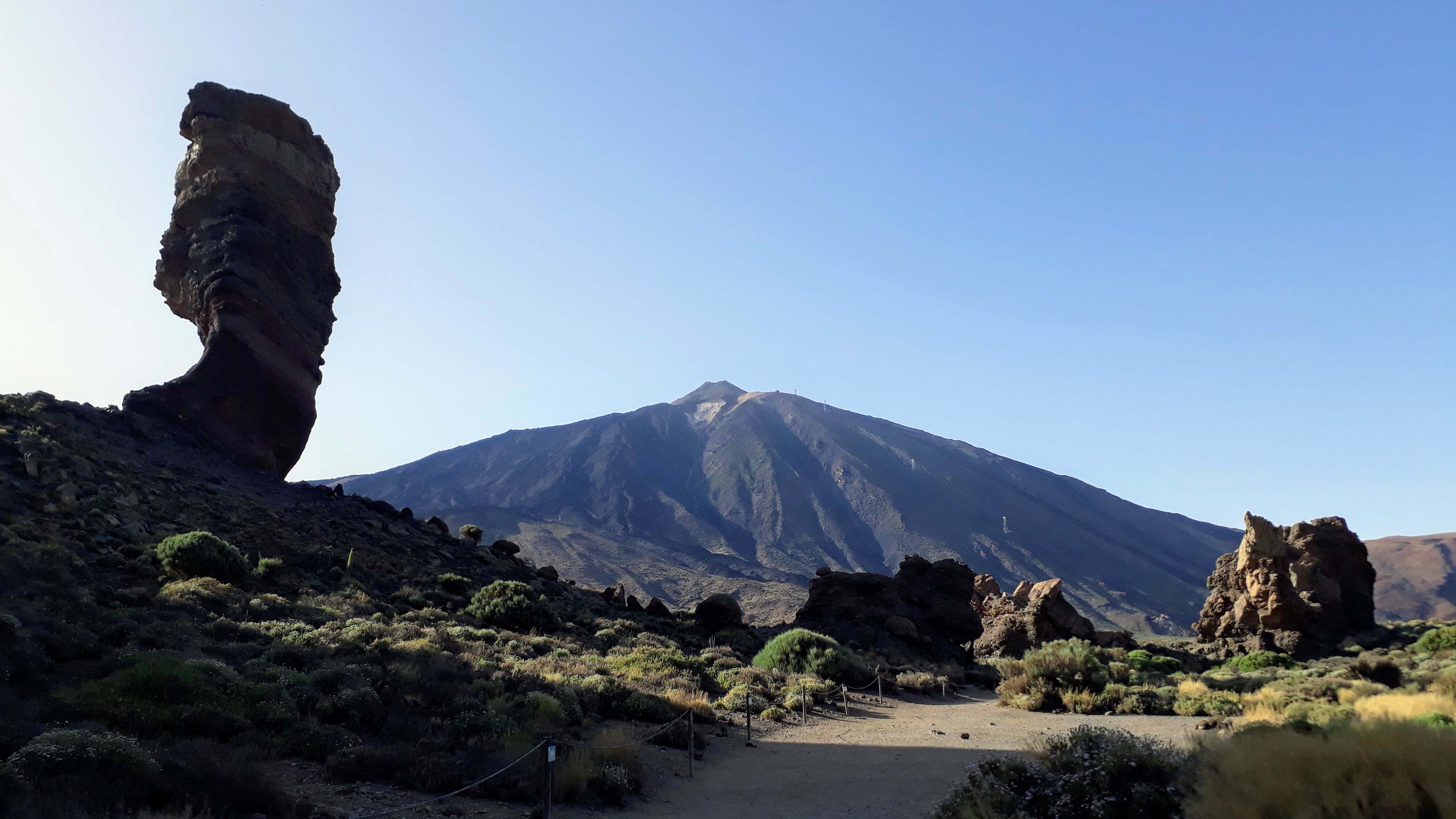
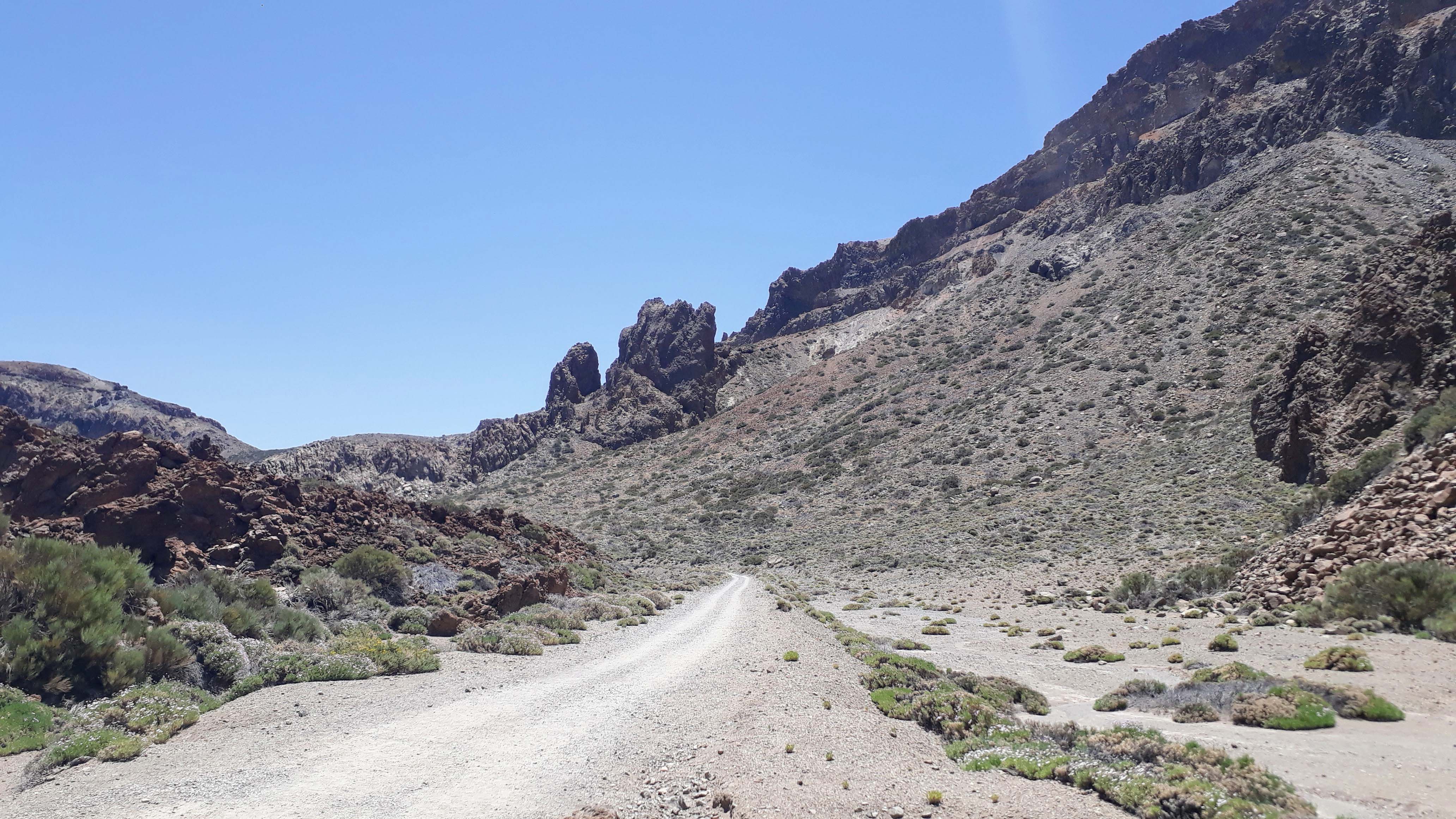
We start our circular trail at the Roques de García. The rock formation is located about five kilometers south of the summit of the Teide at an altitude of about 2200 meters and divides the caldera into a western and an about 150 meters higher eastern half. The age of the Roques is estimated to be up to 1.7 million years, long before the volcanic caldera of today emerged. Particularly noteworthy is the Roque Cinchado: The freestanding rock needle is also called “Stone Tree” or “Finger of God” and is one of the symbols of Tenerife.
From here you can reach the Hotel Parador and the Cañada Blanca Visitor Center in a few minutes. Here we come upon the end of Sendero 4 (Siete Canadas), which we now follow backwards to the fork with the Sendero 31 (Cumbres de Ucanca). Now it’s going to be exhausting for the first time: Extremely steep, the path leads in many serpentines about 300 meters up to the top of the pass Degollada de Ucanca. Here you already have the first panoramic view of most of the caldera.

Instead of following path no. 31, turn left onto Sendero 15 (Alto de Guajara) towards Alto de Guajara and Degollada de Guajara. Now follow another arduous 1.8 kilometers up to the 2718 meter high summit of the Montaña de Guajara. The ascent will then be rewarded with a spectacular panoramic view over the national park and the Roques de García up to the Teide.

No wonder that the world’s first observatory in the high mountains was once located here. Finally, from the top of the highest mountain in the Caldera Range, you can see both sunrise and sunset every day of the year. The observatory was built in 1856 by the Scottish astronomer Charles Piazzi Smyth and reused and expanded in 1910 by the French astronomer Jean Mascart. Today you can see its remains here.
The Sendero 15 (Alto de Guajara) continues to the top of the pass Degollada de Guajara. Depending on how the weather plays, you can either see Tenerife’s south coast from here or look over a sea of clouds. You take the turnoff to Sendero 5 (La Degollada de Guajara) and follow it downhill back into the caldera. At Cañada del Montón de Trigo you will come to Sendero 4 (Siete Cañadas), which will take you back to the Cañada Blanca visitor center.
In total, this route measures around 12 kilometers, for which you need about 4 to 5 hours. All official trails in the Teide National Park can be seen here on a map. In addition, all 41 hiking routes are listed and described here (unfortunately only in German).
4. Pico del Teide: The Trail to the Top
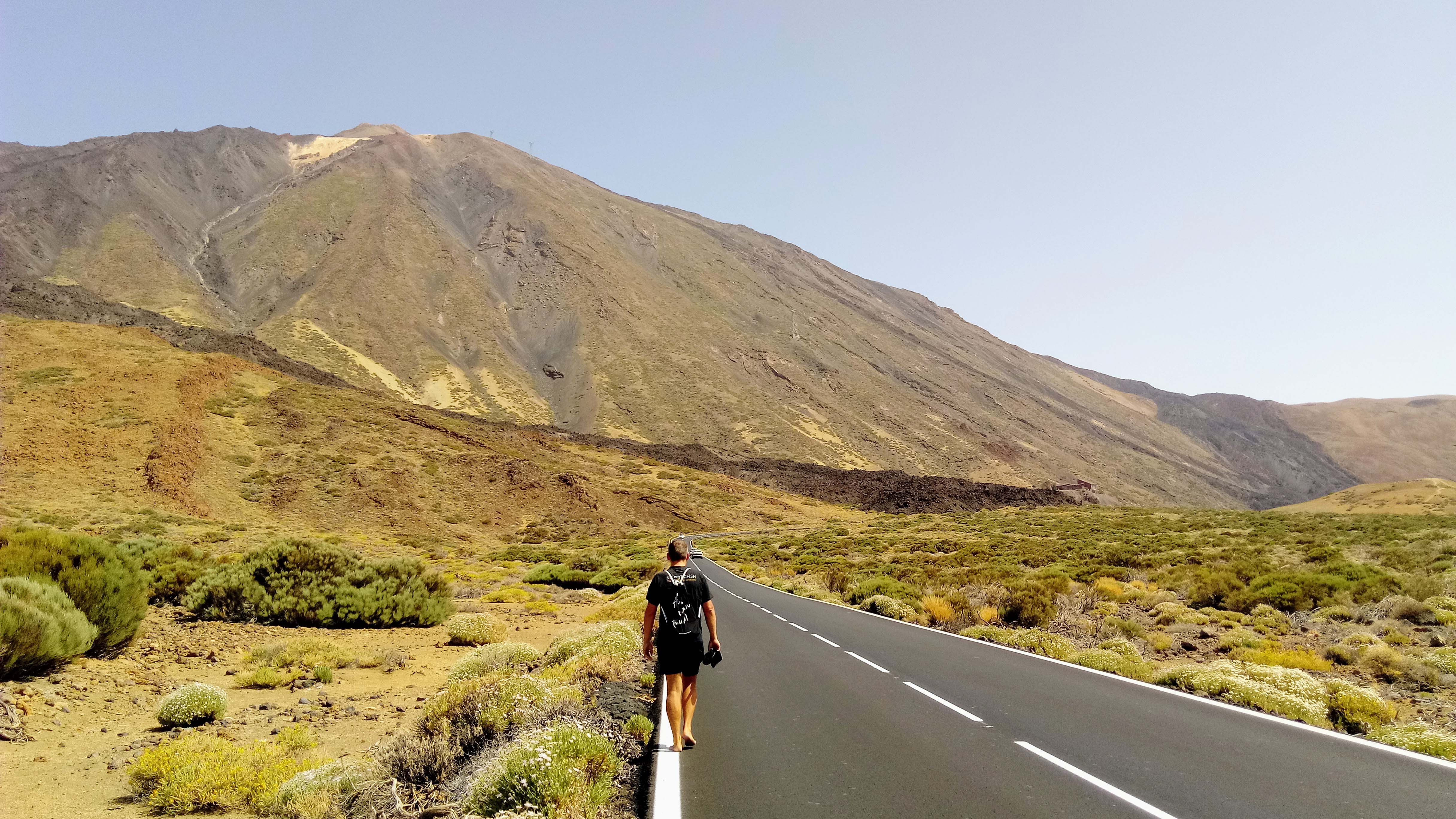
The king of all hiking routes on Tenerife is Sendero 7 from Montaña Blanca to the summit of Pico del Teide at an altitude of 3718 meters. That’s why we dedicated a whole article to it which you can find here:
5. Chinamada – Punta del Hidalgo: Our Highlight
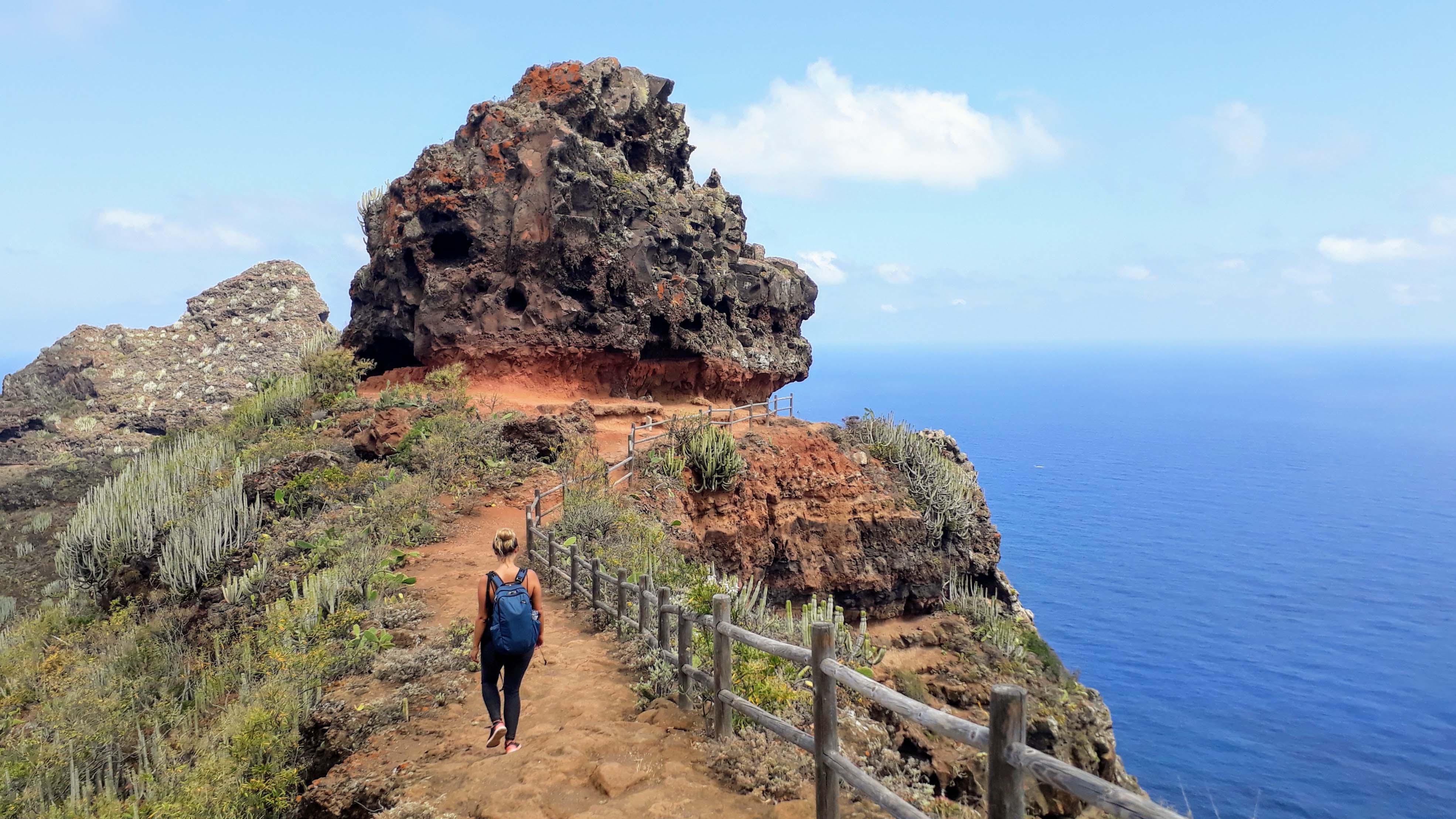
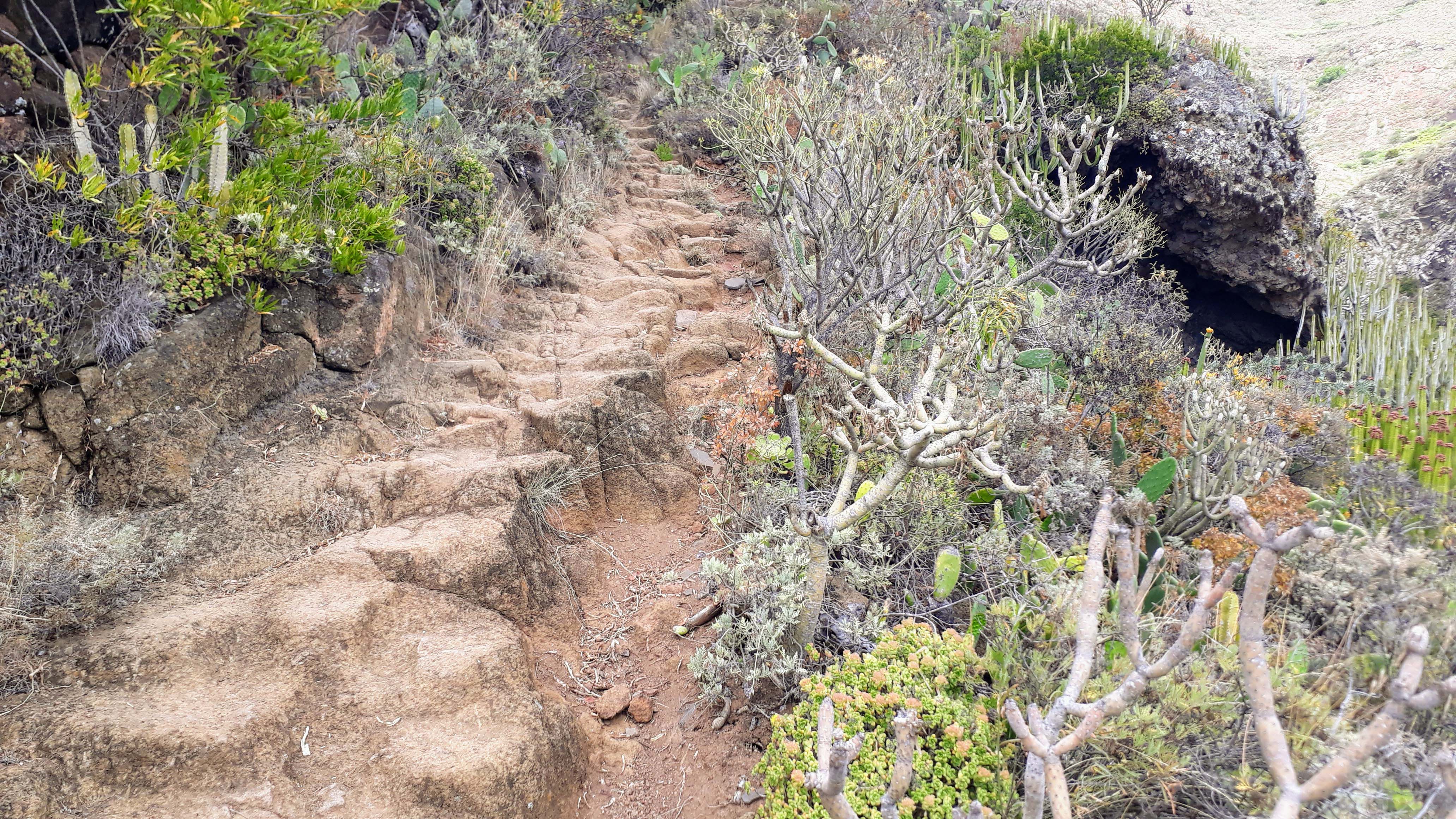
Our number one hiking tour in Tenerife starts in the idyllic cave village of Chinamada in the Anaga Mountains. Secluded and original, it is situated at about 600 meters between rugged mountains and deep gorges and is already a sight in itself.
From the car park at Iglesia de San Ramón you pass the church until you reach the end of the tarred road, where you will find yourself in the middle of terraced fields. The steep ravine Barranco del Tomadero leads down along rocks and through caves. Over and over again, you’ll get beautiful views of the valley or over the coast.

Directly above the beach Playa de los Troches is the rock Roque de Los Dos Hermanos, which you’ll reach in the last third of the walk. Now going zig-zag, the steep descent on the south side of the rock towards the gorge Barranco del Río begins. Through a dried-up river bed you reach the eastern edge of the peninsula of Punta del Hidalgo.
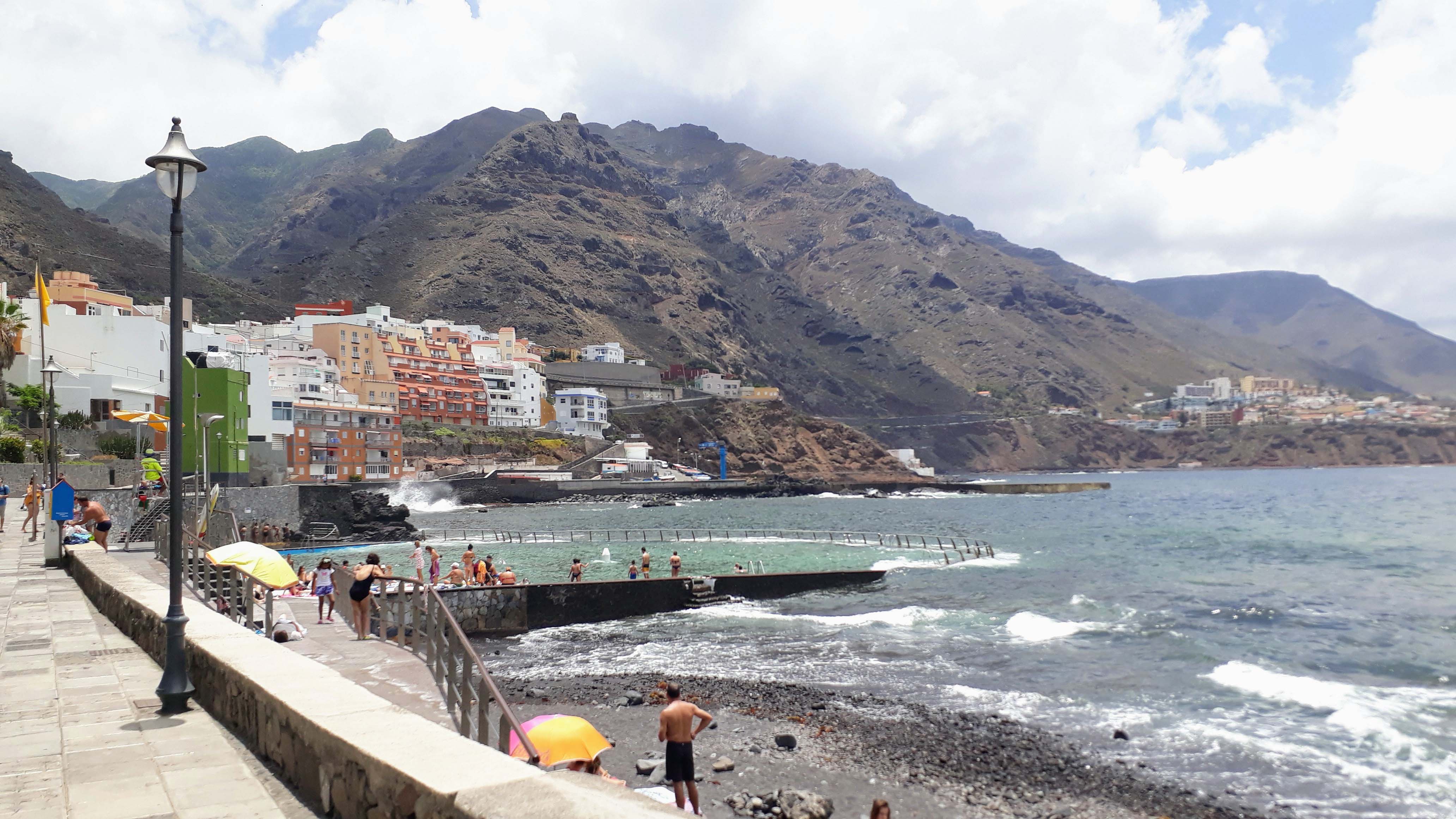
If you go either across the town or along the coastline, you will reach the public and free open-air swimming pool with seawater Piscina Natural de Punta del Hidalgo. Here you can refresh yourself and cool off before heading back to Chinamada – the ascent is really exhausting and kind of tough!

For the way there and back, classified with the difficulty level T3 “challenging mountain hiking”, of a total of 14 kilometers we needed almost 10 hours including swimming and everything. But we can say one thing: It was totally worth it! If you don’t want to hike for so long, you can choose one direction only and then go the other way by bus. Shorter walks are possible to the viewpoints Mirador hacia el Roque de Los Pinos and Mirador Aguaide.
In a nutshell: We’re on fire for this hiking trail. On the way it always seemed wanting to surpass itself in its beauty. Especially in combination with the seawater pool in Punta del Hidalgo, the path perfectly reflects the versatility of Tenerife. We strongly recommend it to every experienced hiker! Be sure to take enough water, provisions and sunscreen with you.
6. Masca Gorge: Closed at least until March of 2019

The Masca Gorge is named after the mountain village of Masca, which is located in a volcanic crater at an altitude of about 650 to 800 meters above sea level in the Teno mountain range. In the past, one of the most impressive hikes on Tenerife could be made here. However, the gorge was closed for an indefinite period of time by the authorities of the island of Tenerife at the end of February of 2018. The reason for this is the long-standing increase in serious accidents in the Barranco.
The eventual trigger for the closing were seven German hikers who ignored all storm forecasts by the state meteorological service as well as the closure of all hiking trails for that day. Due to the storm, the wanderers had to spend the night in the Masca Gorge and could only be recovered the next morning. At present, all technical advice recommends that the closure of the gorge be maintained until a system has been established to secure the Barranco and the measures have been implemented.

In September of 2018, the Cabildo (governing, administrative and representative body) of Tenerife commissioned the repair of the trail through the Masca Gorge. The thorough rehabilitation of the path and the so far only provisionally repaired jetty shall be completed in March of 2019.
In addition, a completely new model for the visits will be prepared. For this, the tolerable capacity of visitors of the ravine is to be analyzed and then their number will be limited to that. The aim of the island administration is to bring the protection of the ecologically valuable gorge and landscape in harmony with the number of visitors.
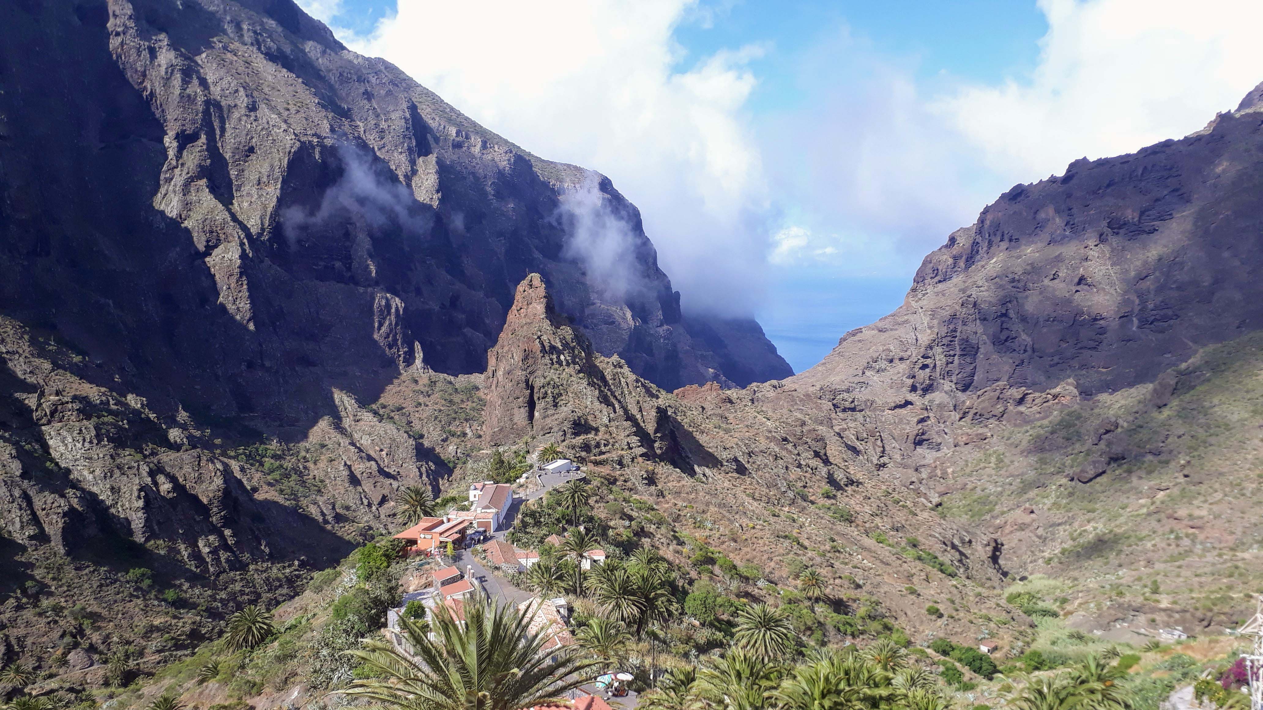
If the trail will be opened again, the tour through the Masca Gorge will begin in the lower center of the village and then lead through a narrow Barranco down to the sea. However, the hike has a fairly high level of difficulty, so you should only enter it well equipped. The circular route covers about 8.5 kilometers or 6 hours. Also very popular is the one-way hike followed by a boat trip to Los Gigantes. From there you can return to your car by bus or taxi.
Our Hiking Equipment

Generally speaking, we would advise you to pack as light as possible. Of course, you should have all the essentials with you, but don’t underestimate that every extra gram on your back can become a real burden. We always try to pack everything in only one backpack, so we can alternate with carrying it. Also find out if there are any springs of drinking water or buying opportunities on the way, so that you can carry less water with you.
What we always take with us:
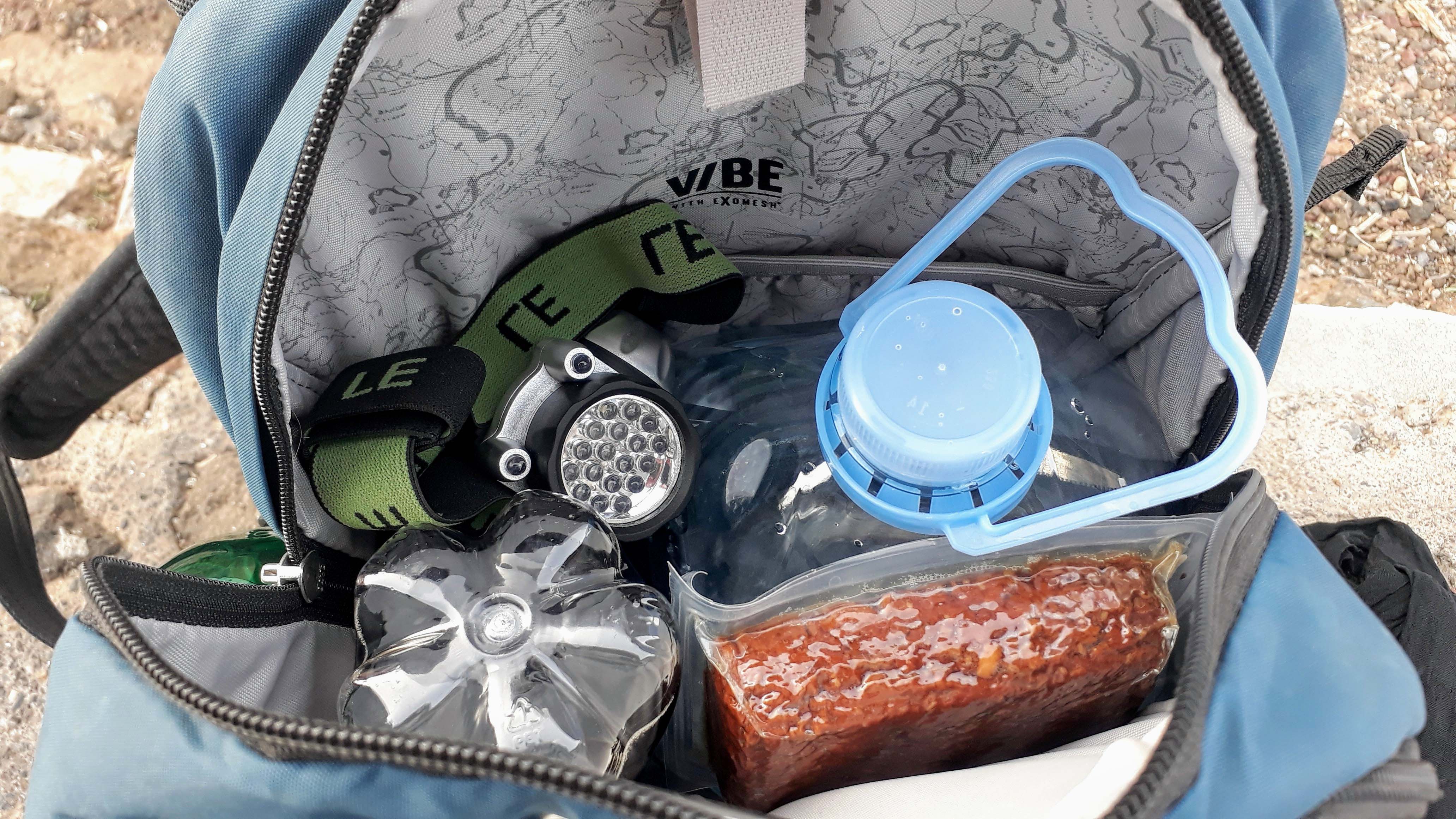
- a well-fitting hiking backpack, we use the Pacsafe Vibe with 25 liters capacity
- good footwear, depending on the weather we either wear our water and snowproof hiking boots by Decathlon or simply comfortable sneakers
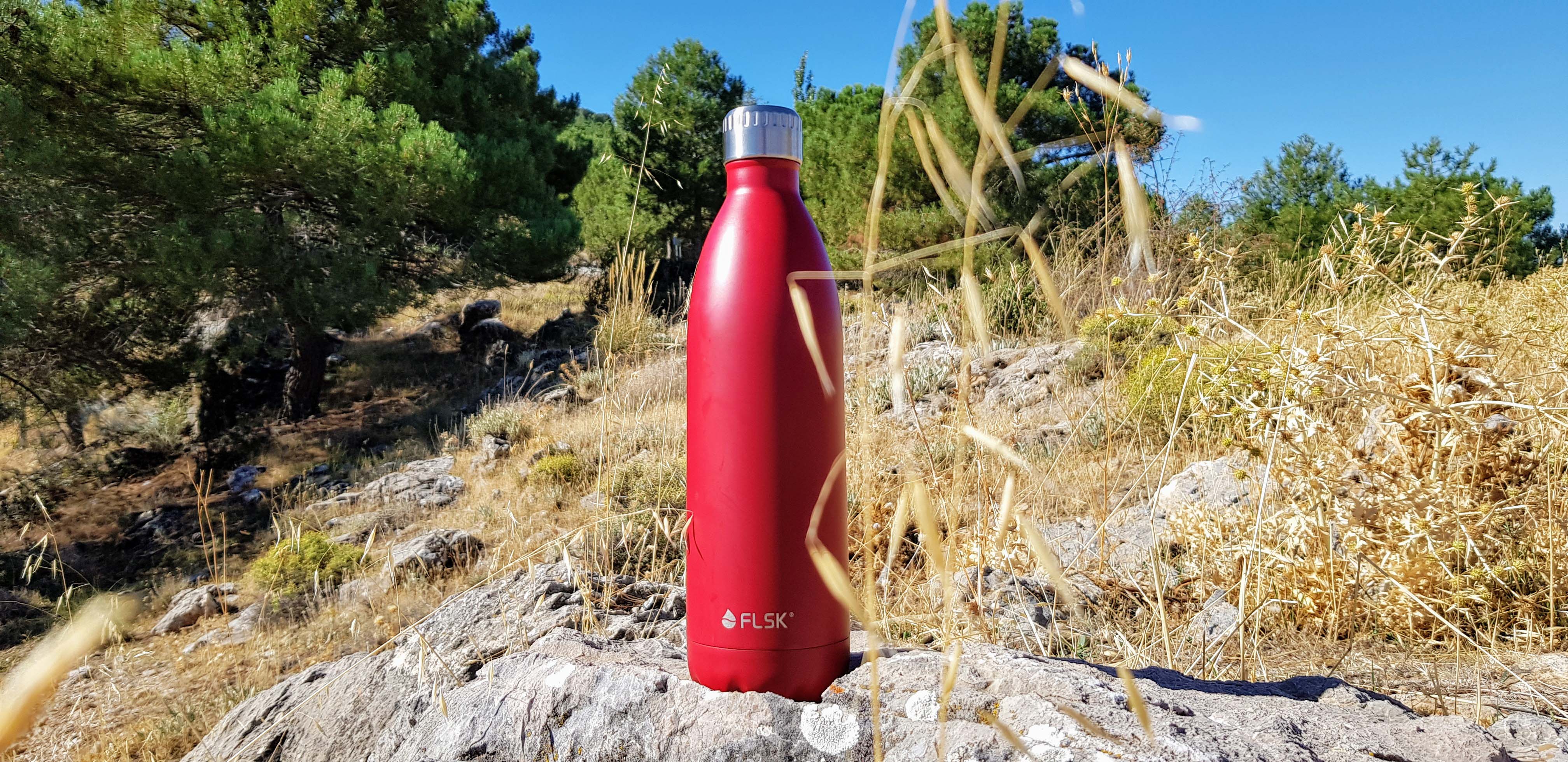
- enough water, we just fill in tap water in our FLSK thermoses, sometimes we take coffee or juice
- enough food/snacks, we mostly take cereal bars, fruit and a smoked tofu
- a scarf against cold or heat and sun, we always have our scarves from Egypt with us
- our fully charged smartphones for GPS tracking, route guidance and emergencies
- a power bank and charging cable for the case the battery gives up
- sunscreen, the sun shouldn’t be underestimated, especially in the cool mountains
- some cash, ’cause you never know
- band-aids and painkillers, we take ibuprofen against everything 😀

What we sometimes take with us:
- a garbage bag, provided we produce non-organic waste, such as the packaging of the smoked tofu
- an extra jacket or sweater, in case we know it’s getting colder
- hat and gloves, see above
- a headlamp, in the event we start or arrive in the dark
- our travel drone, the DJI Spark, if we want to take beautiful shots because it’s our best camera

What Else Should Be Considered

- distance and difficulty of the track, shouldn’t be underestimated
- special features of the hike: Do you need a particularly high surefootedness? Are there any dizzying passages? Etc.
- weather, especially severe weather warnings, in bad weather we don’t even start hiking
- the altitude, from an altitude of 2000 meters inform yourself about the altitude sickness or acute mountain sickness
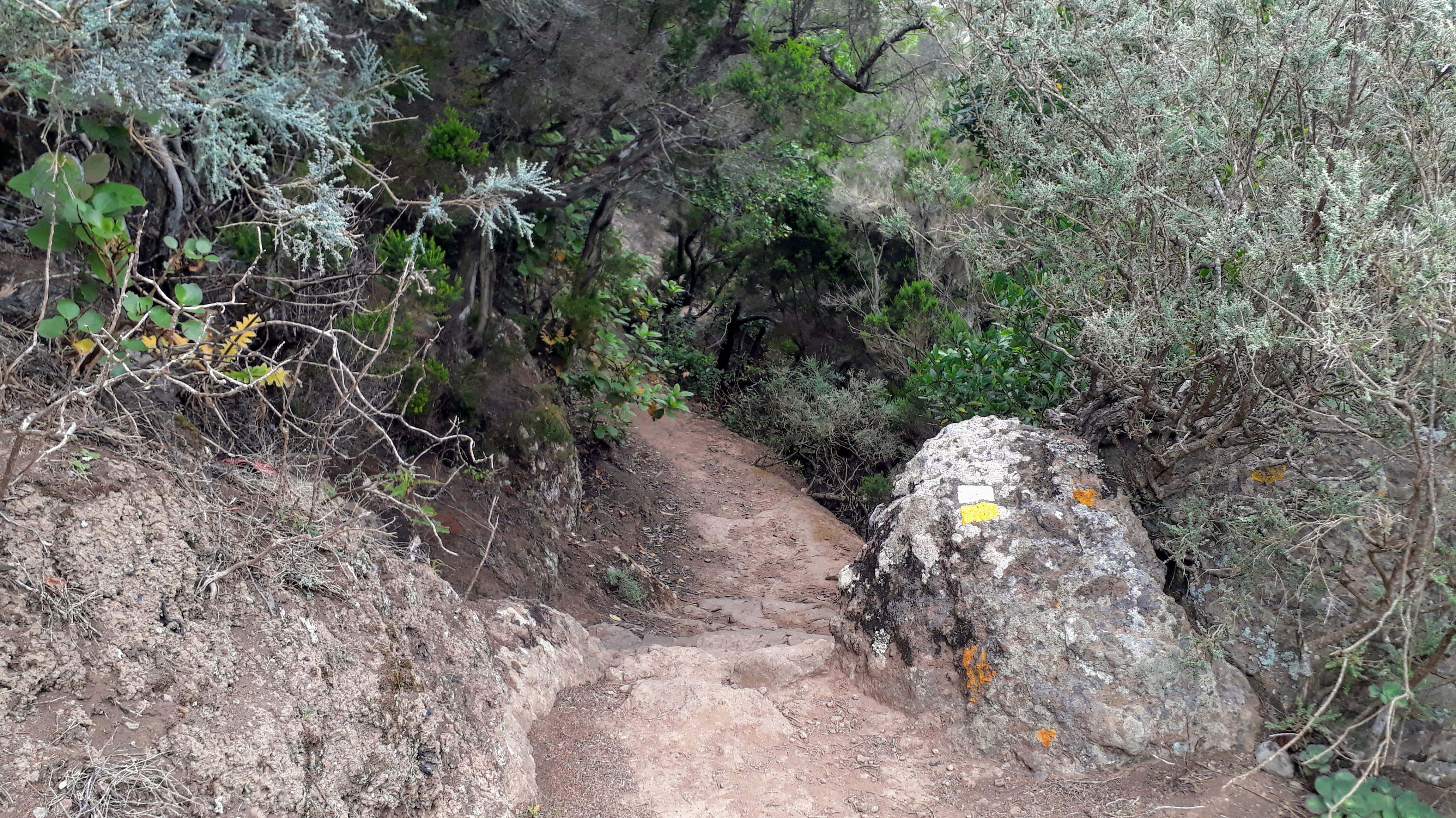
- pay attention to path markings
- Always take your litter with you!
These were already our 5 most beautiful hiking trails in Tenerife. All these tips are based on our personal experience. Feel free to let us know your favorite routes in the comments. The other Canary Islands are also suitable for hiking, so check out all our Canary Islands posts.
More of Tenerife
Take a look at our bird’s-eye video of Tenerife:
And here’s our Tenerife article about the ultimate road trip:
Our Canary Islands Guide